JoeHogan
RVF Supporter
- Joined
- Nov 3, 2019
- Messages
- 3,666
- Location
- Florida
- RV Year
- 2024
- RV Make
- Newmar
- RV Model
- Dutch Star 4311
- RV Length
- 43
- Chassis
- Spartan
- Engine
- Cummins
- TOW/TOAD
- 2018 Ford Flex
- Fulltimer
- No
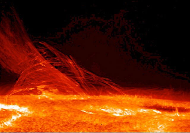
‘Strongest of its kind’ flare may cause blackouts, massive solar storm on Earth
The largest solar flare recorded since 2017 erupted Thursday morning, marking the latest episode in an active period for the sun.
ground.news


